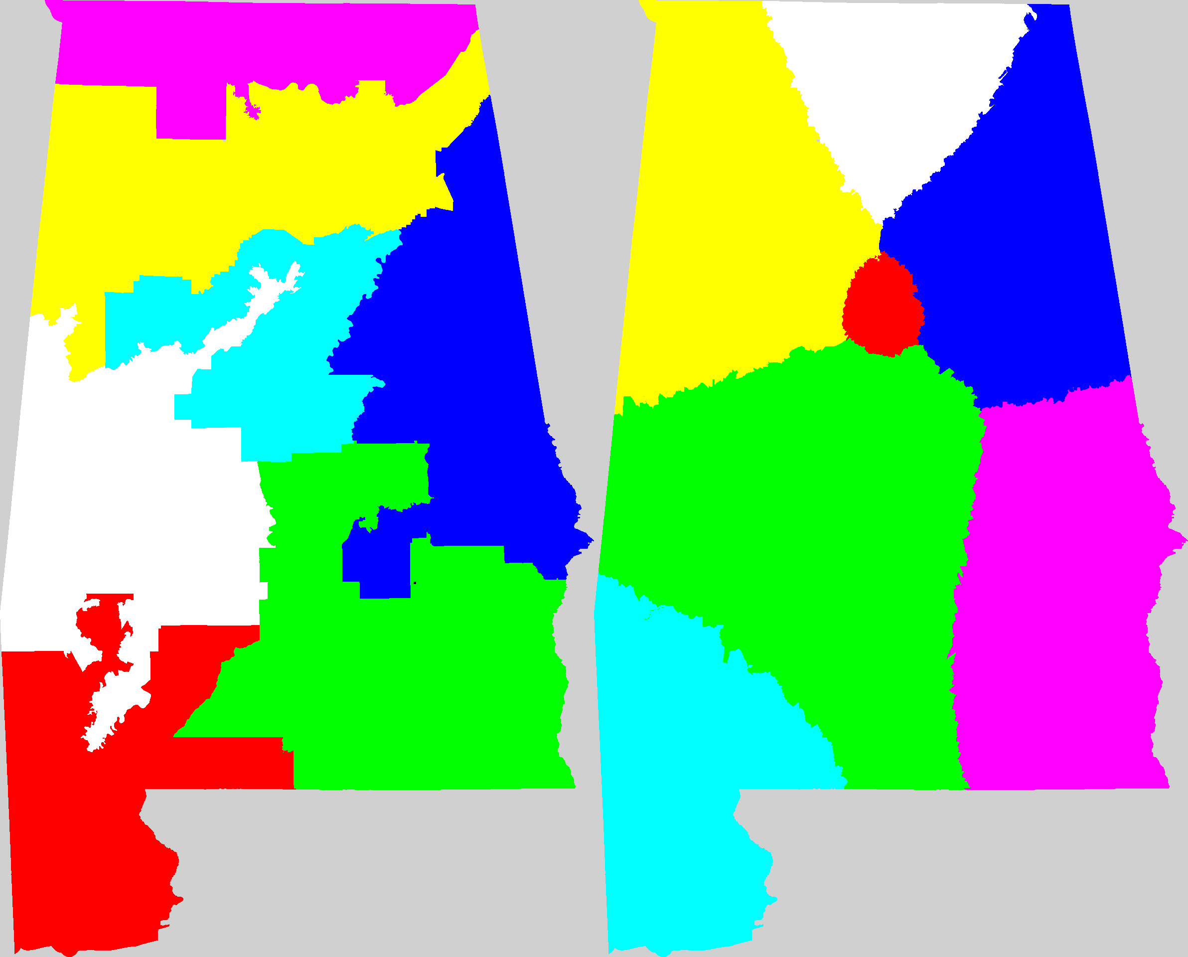
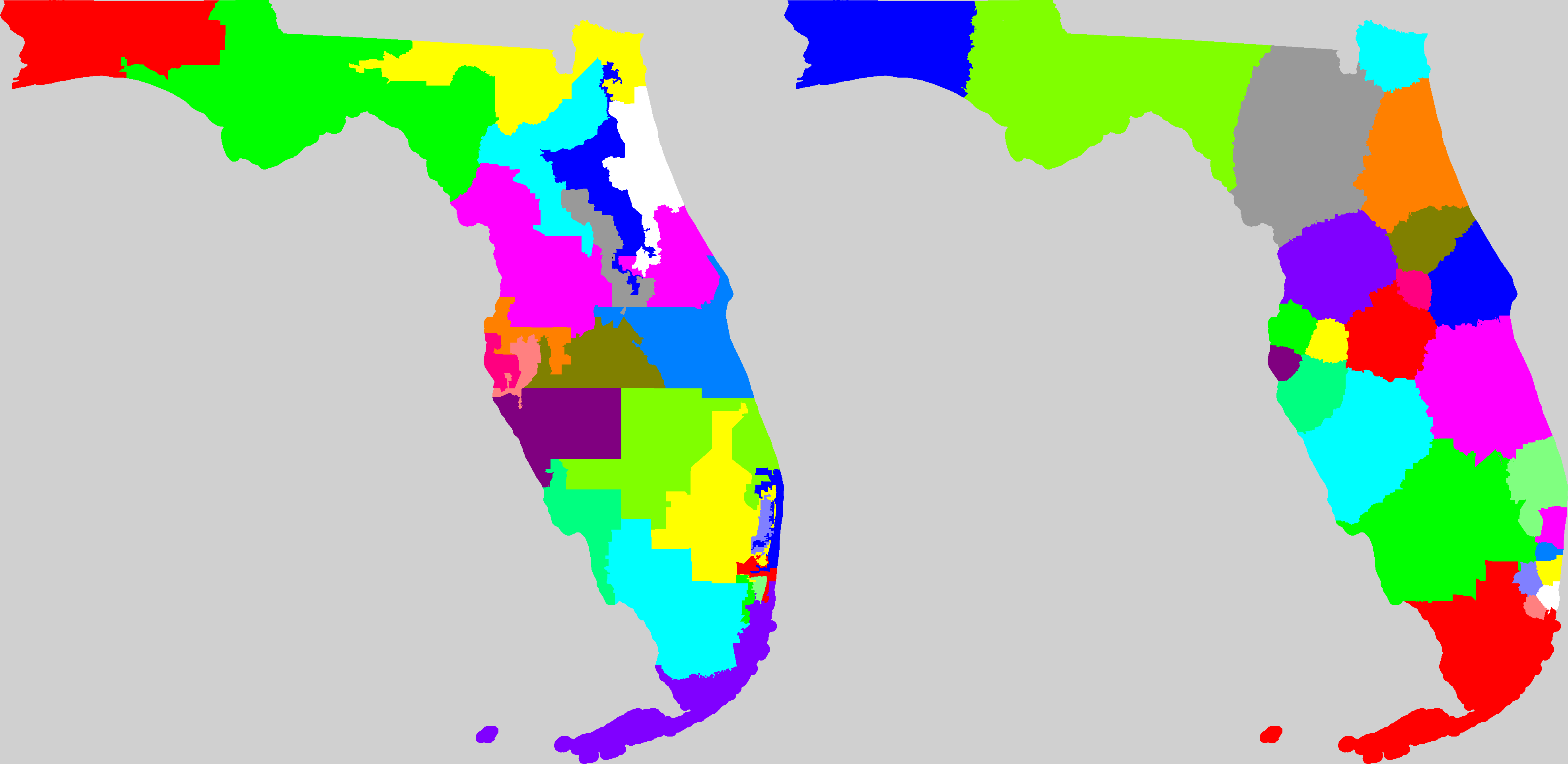
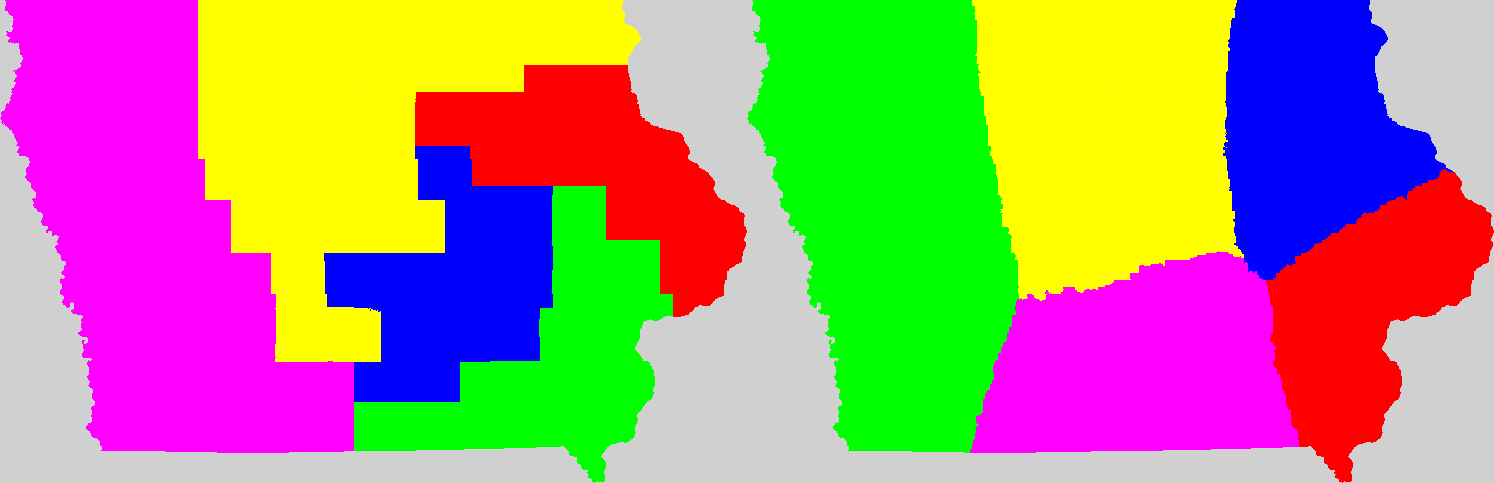
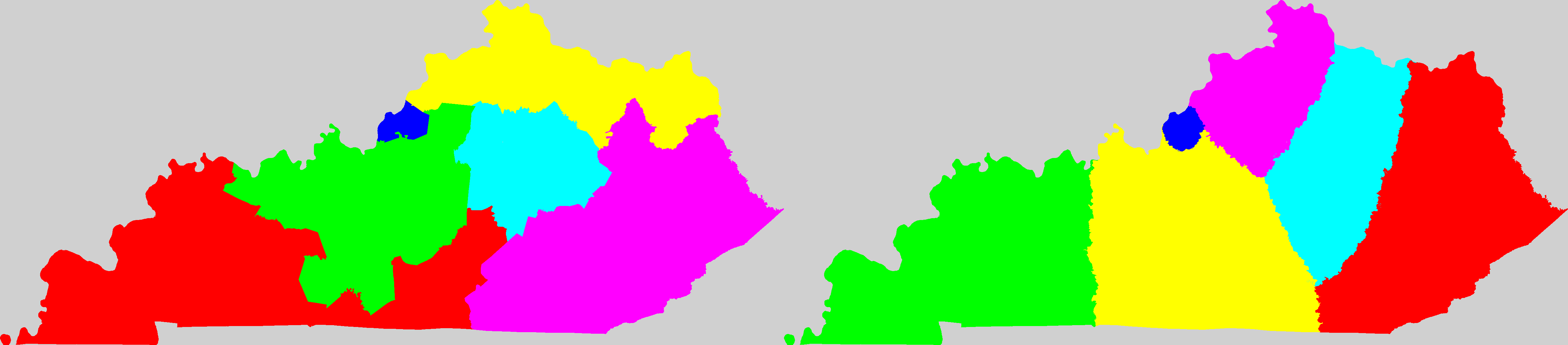
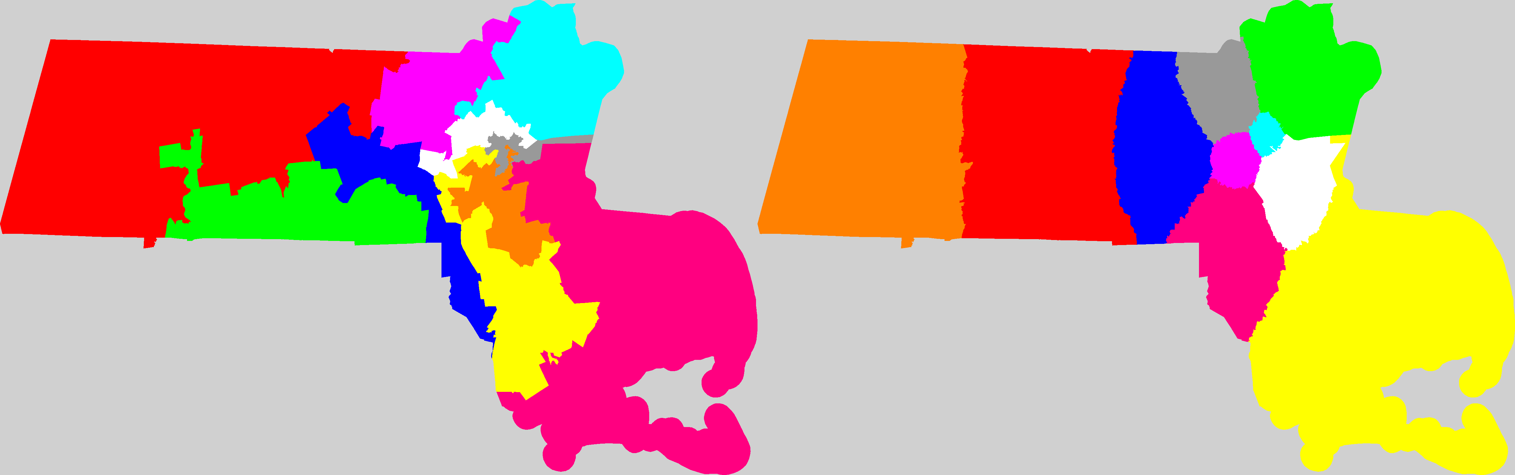
| States shown with current congressional district map and a possible solution I generated. (click for larger view) | "Km/p" is the average distance per person in kilometers to the center of their district.
"spread" is the difference in population between the least populous district and the most populace district.
"std" is the standard deviation of the populations of the districts. |
| AL |  | Current: 71.388340085
My Way: 58.051565 |
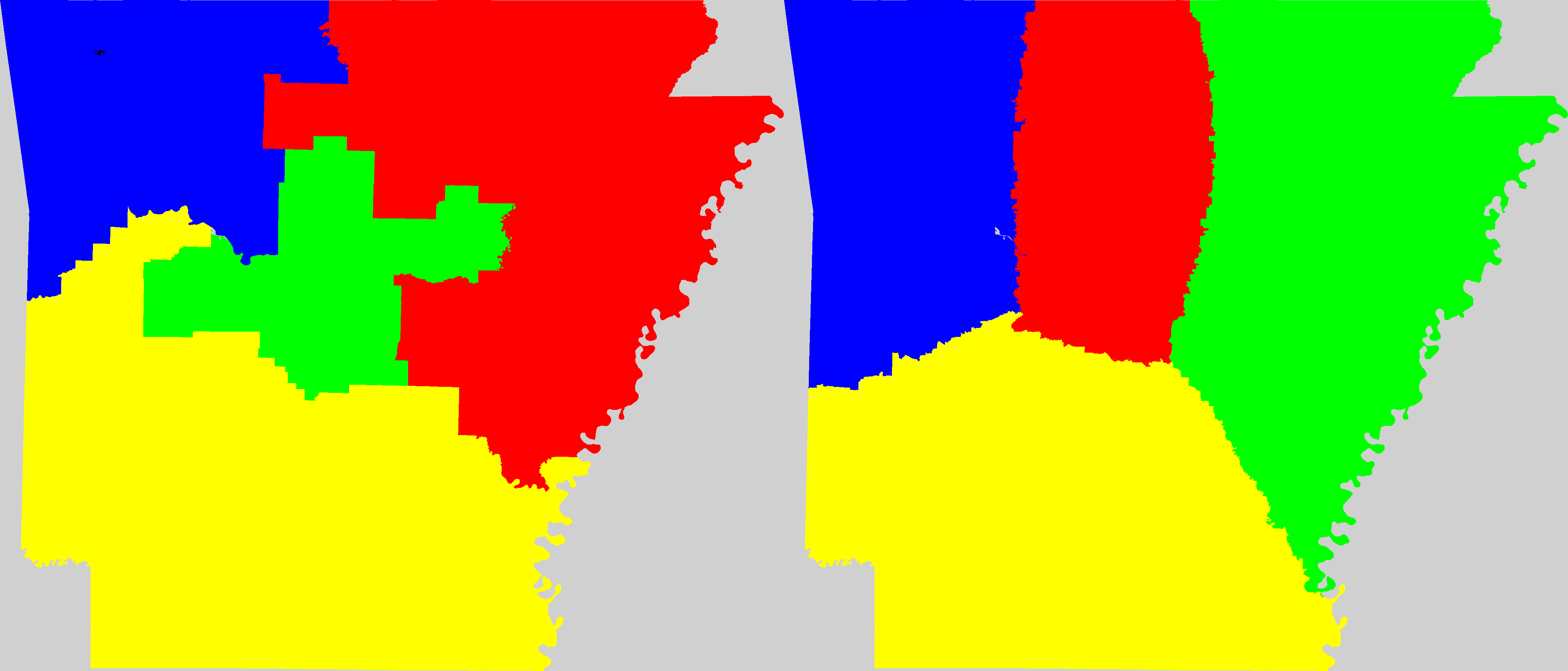
| AR | 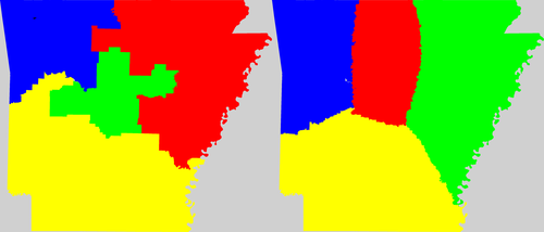 | Current: 81.458162692
My Way: 85.328578 |
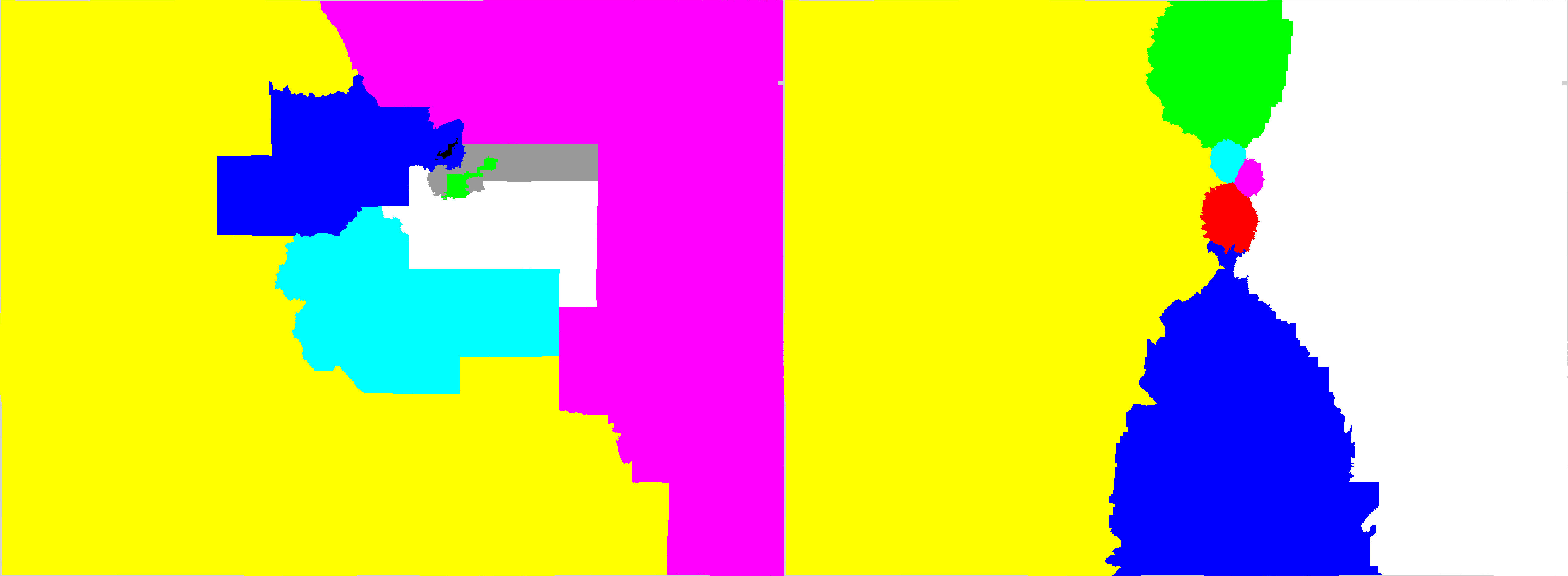
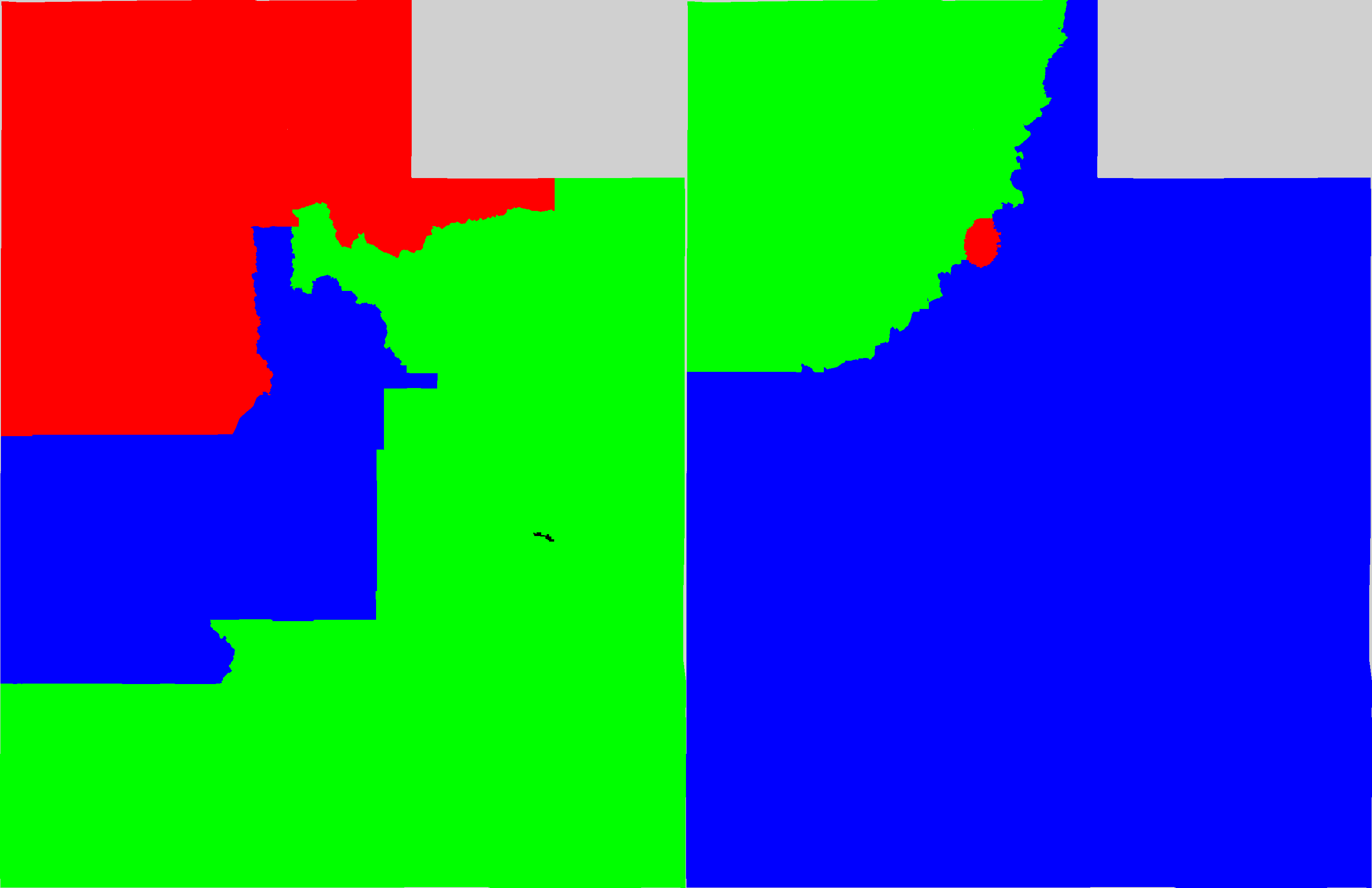
| AZ | 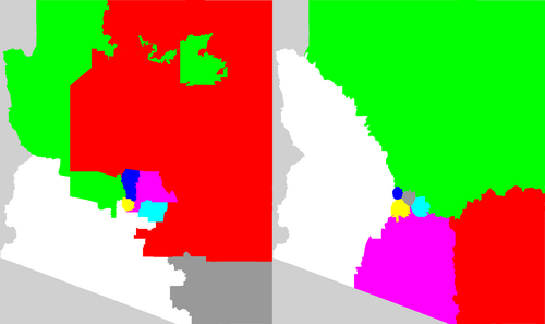 | Current: 95.511978206
My Way: 69.146270 |
| CA | 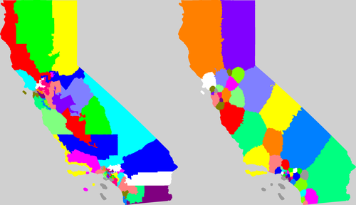 | Current: 43.712749734
My Way: 29.131231 |
| CO |  | Current: 100.01580166
My Way: 69.199437 |
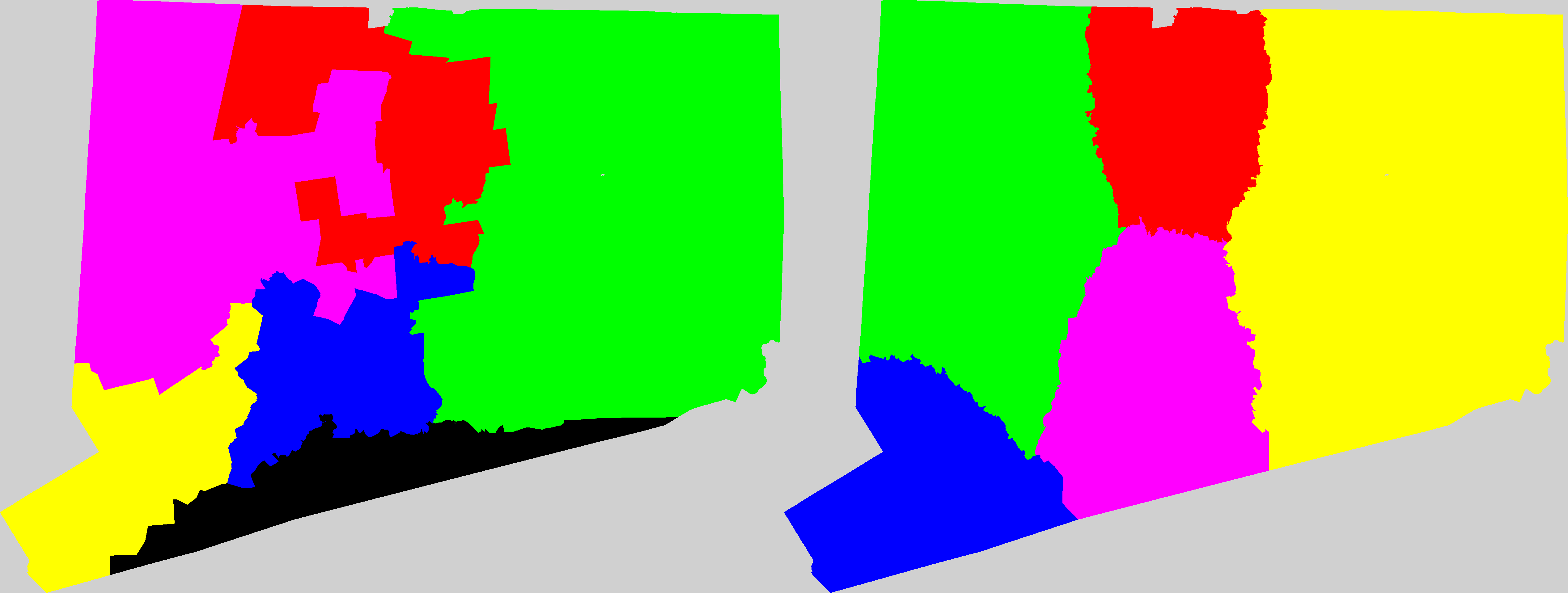
| CT | 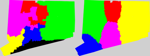 | Current: 25.494883341
My Way: 23.439092 |
| FL |  | Current: 47.31424839
My Way: 31.359312 |
| GA | 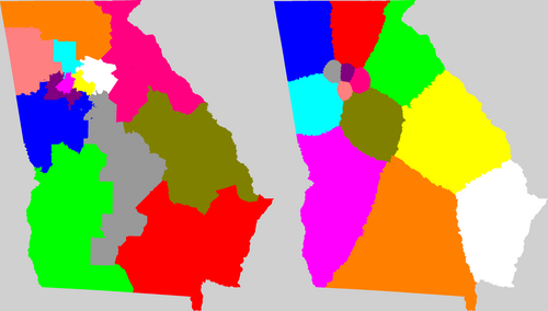 | Current: 55.786409565
My Way: 42.542917 |
| HI |  | Current: 98.765641166
My Way: 149.979647 |
| IA | 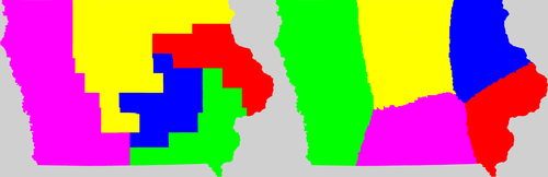 | Current: 97.04749258
My Way: 81.102980 |
| ID | 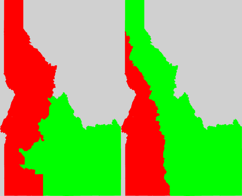 | Current: 200.39020809
My Way: 199.627763 |
| IL | 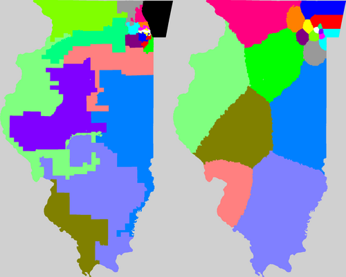 | Current: 41.48940462
My Way: 29.213294 |
| IN | 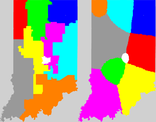 | Current: 53.433226767
My Way: 43.354208 |
| KS |  | Current: 90.197034207
My Way: 86.569420 |
| KY |  | Current: 67.03863196
My Way: 59.437082 |
| LA | 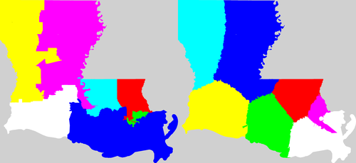 | Current: 55.480997469
My Way: 57.889385 |
| MA |  | Current: 28.830289269
My Way: 21.643817 |
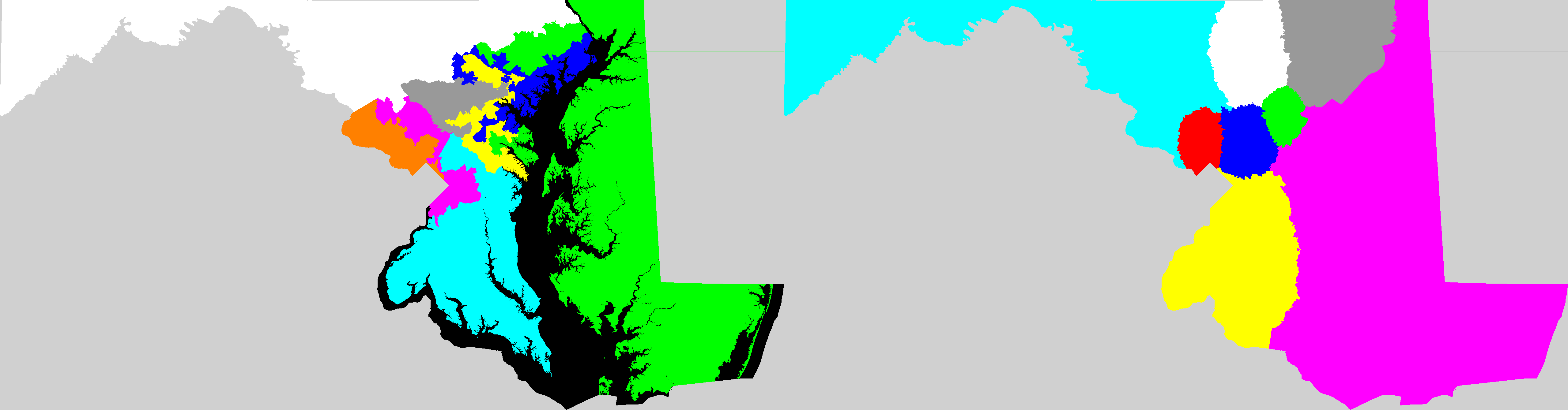
| MD |  | Current: 35.578708302
My Way: 31.478069 |
| ME | 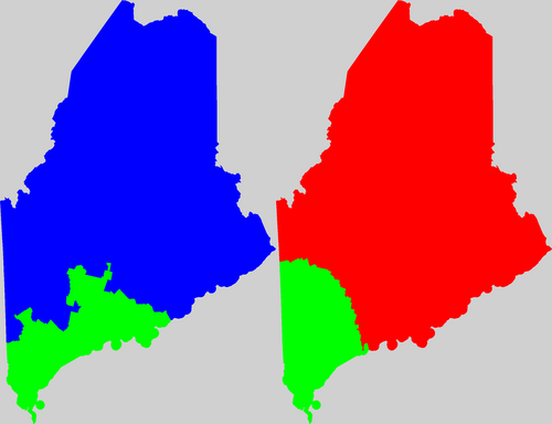 | Current: 101.5022461
My Way: 93.200011 |
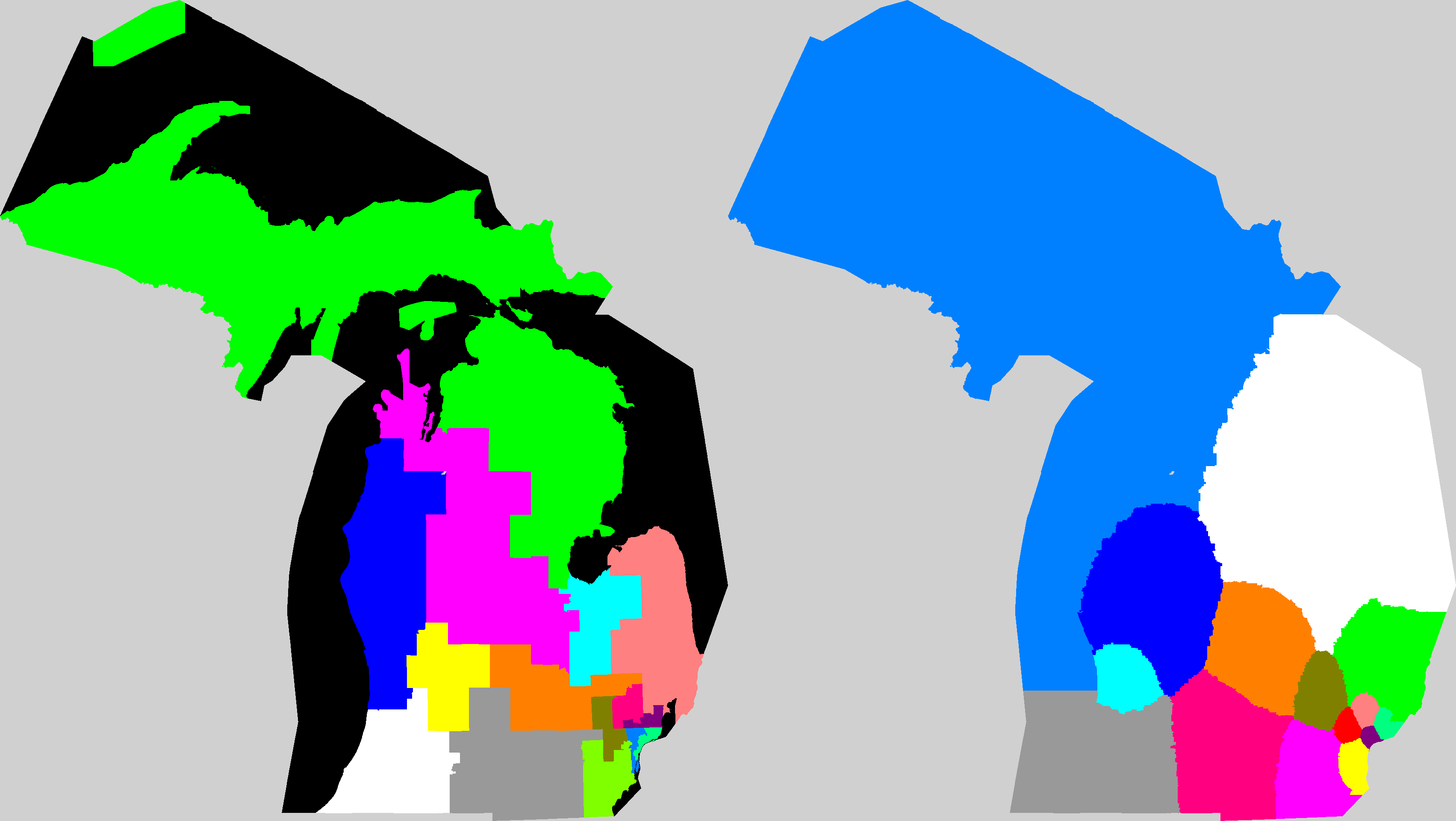
| MI |  | Current: 50.769320447
My Way: 44.010441 |
| MN | 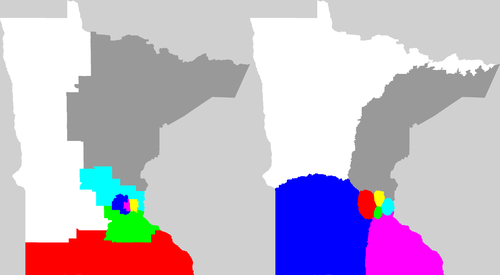 | Current: 69.863354839
My Way: 64.681505 |
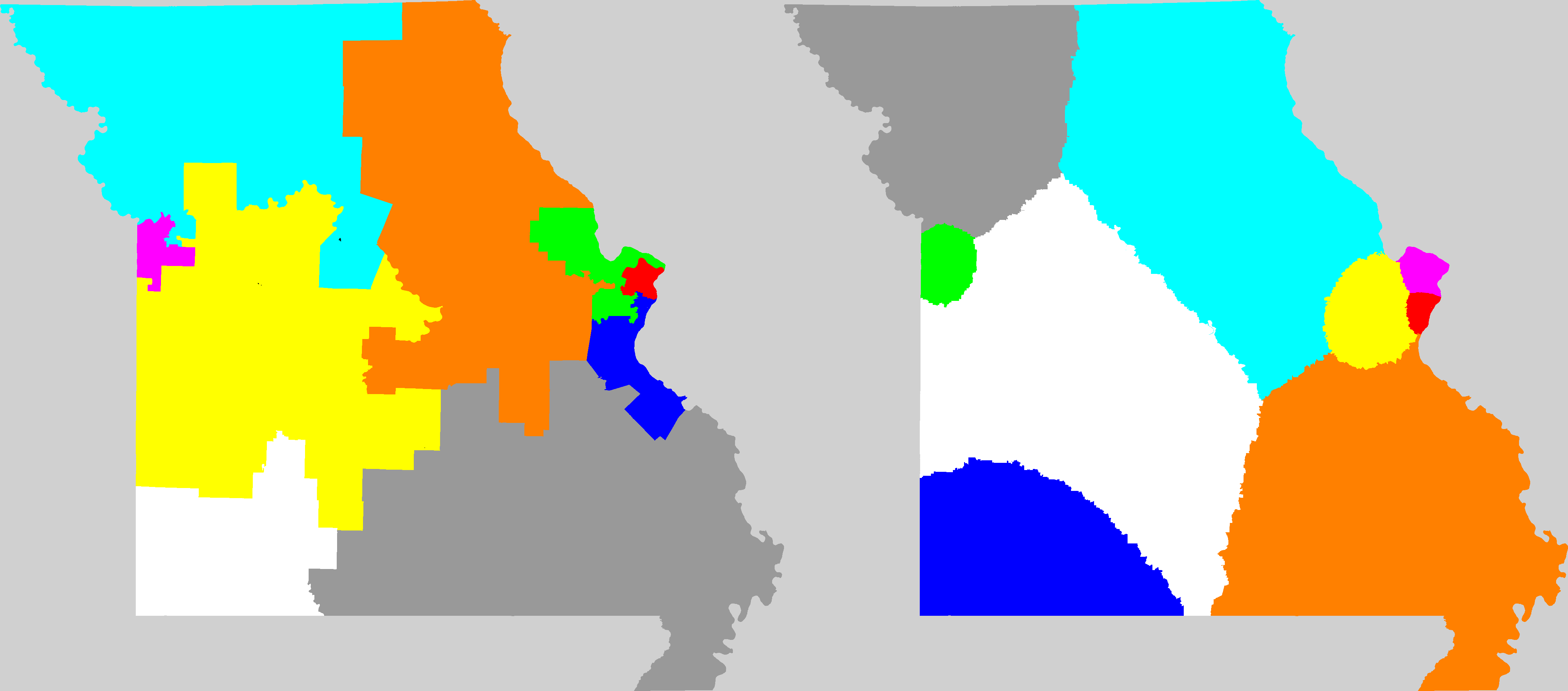
| MO |  | Current: 63.895602097
My Way: 55.157848 |
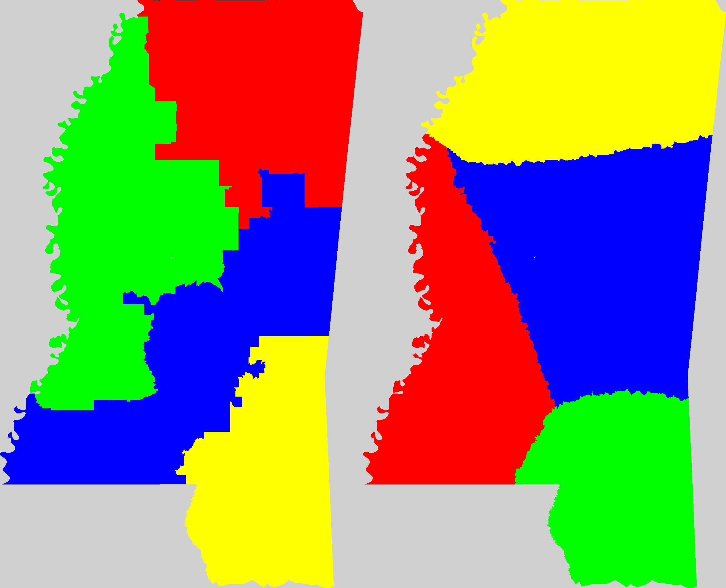
| MS | 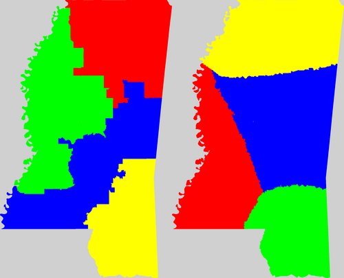 | Current: 84.055756539
My Way: 80.035218 |
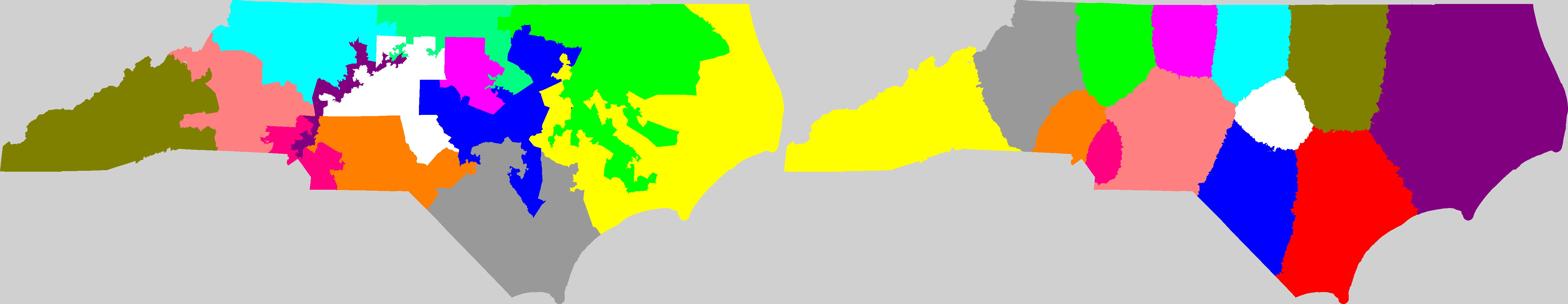
| NC |  | Current: 55.617187889
My Way: 41.599747 |
| NE |  | Current: 107.19578668
My Way: 104.416161 |
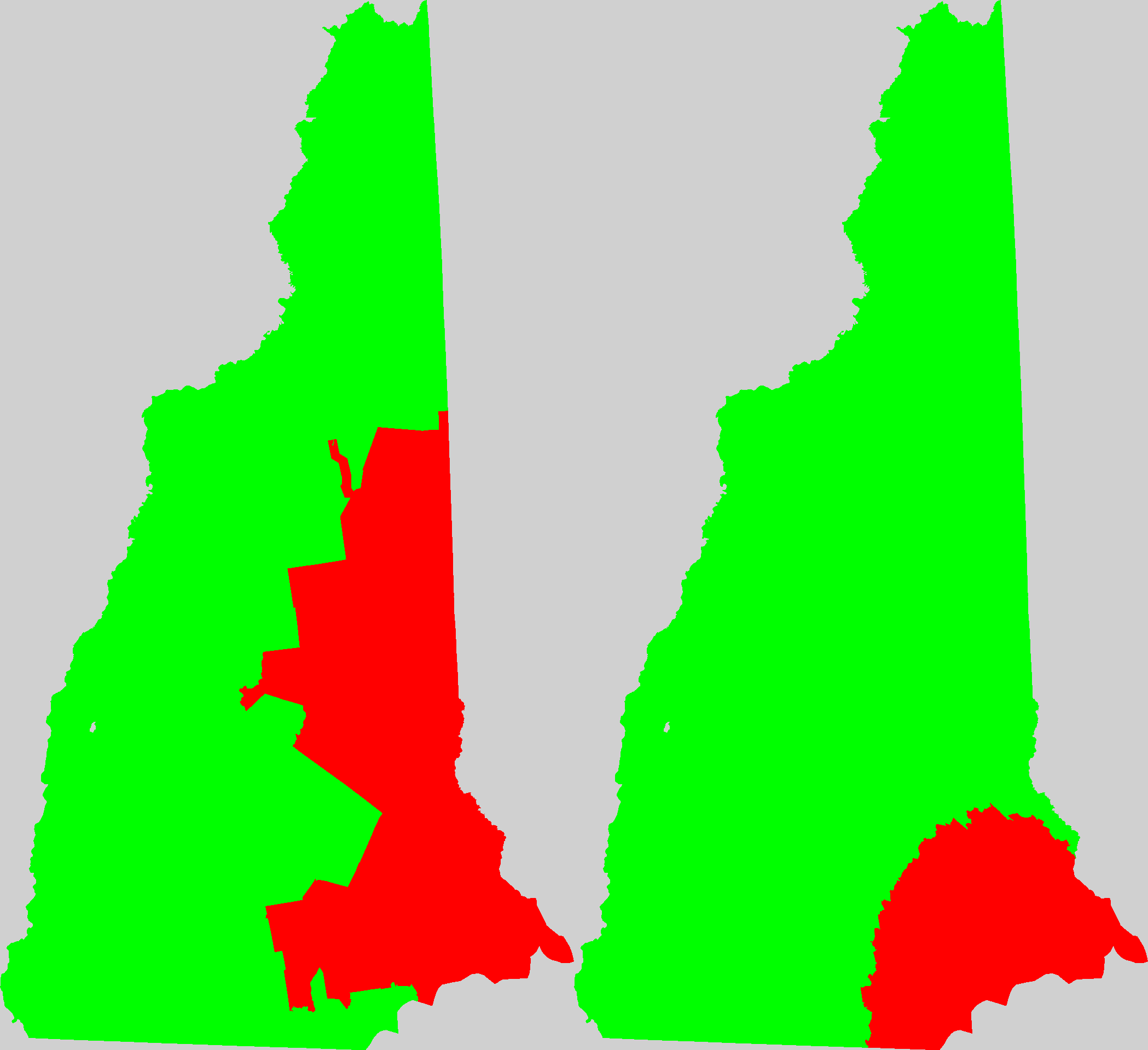
| NH |  | Current: 70.768088935
My Way: 53.594744 |
| NJ | 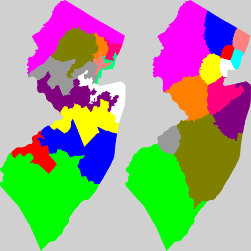 | Current: 23.719460004
My Way: 16.313603 |
| NM |  | Current: 143.12597852
My Way: 118.391475 |
| NV | 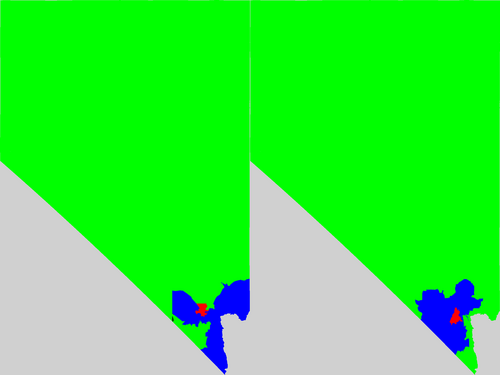 | Current: 119.62132099
My Way: 113.916965 |
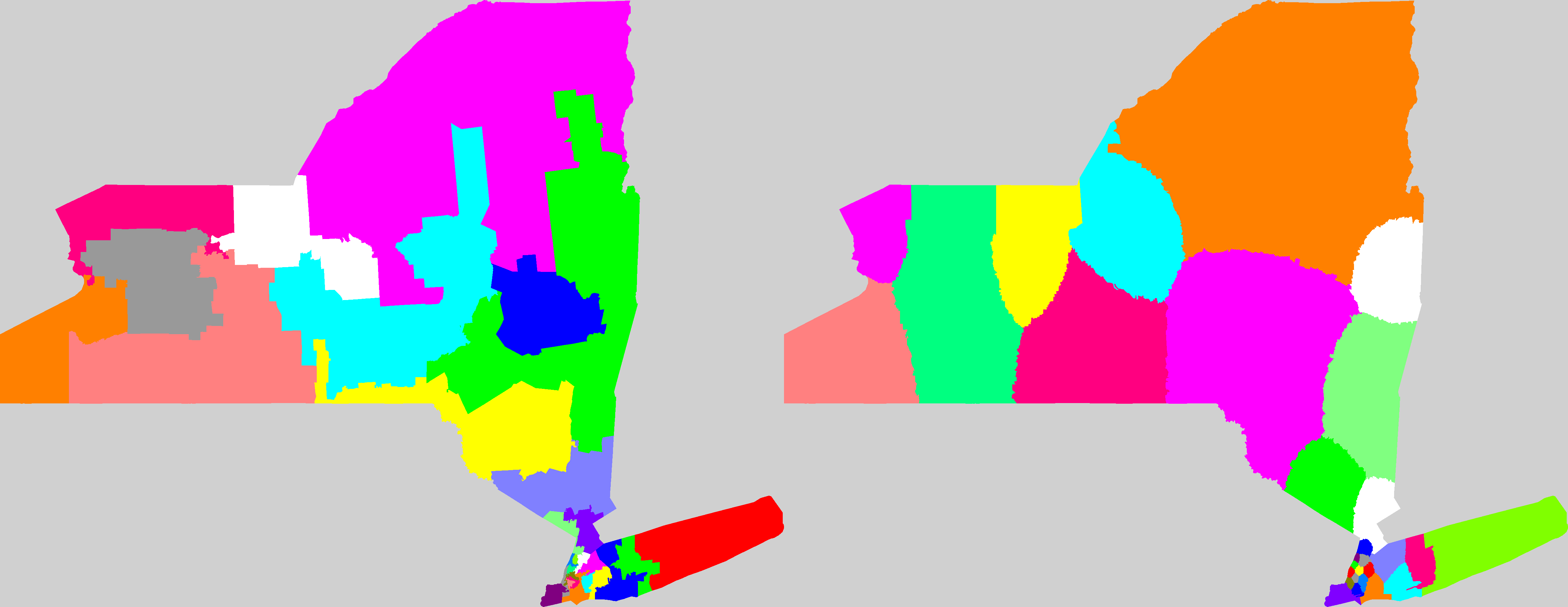
| NY |  | Current: 32.145911908
My Way: 23.448747 |
| OH | 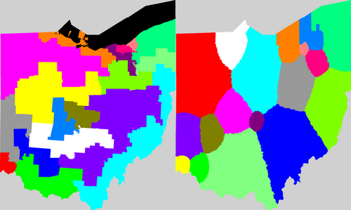 | Current: 49.006110957
My Way: 32.828935 |
| OK | 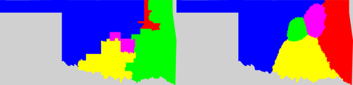 | Current: 90.105557208
My Way: 85.378651 |
| OR | 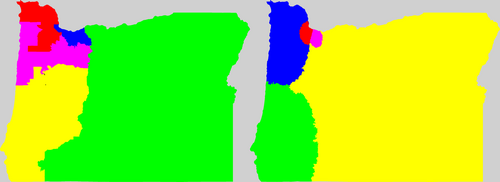 | Current: 103.57398509
My Way: 91.085470 |
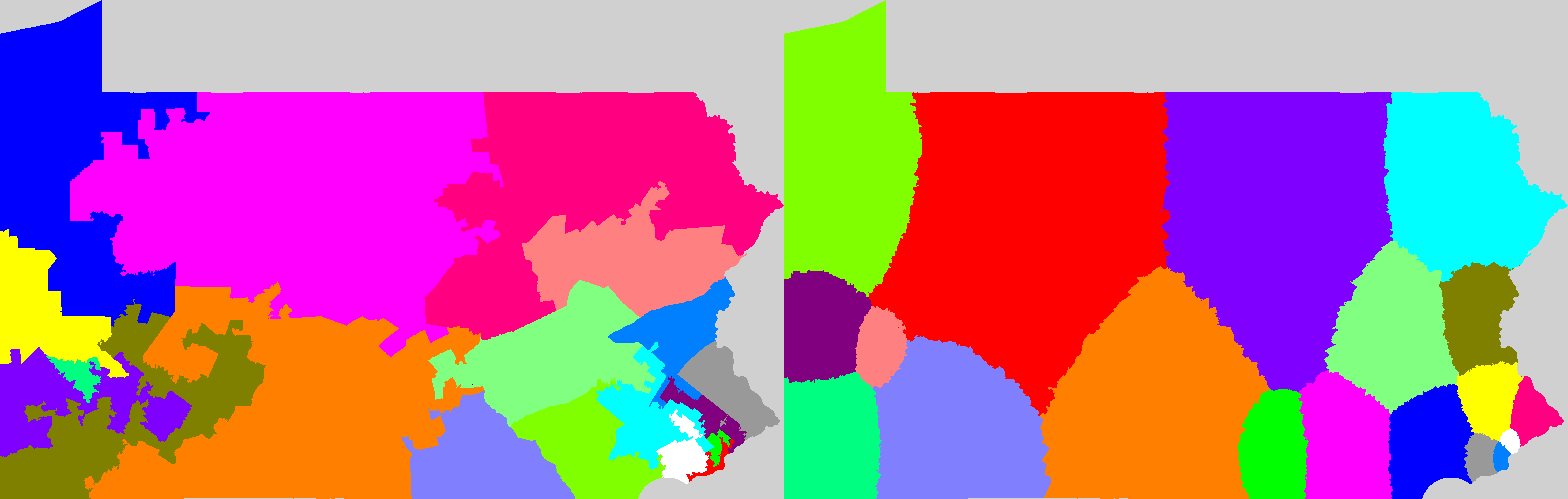
| PA | 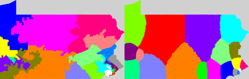 | Current: 36.703984821
My Way: 30.191386 |
| RI | 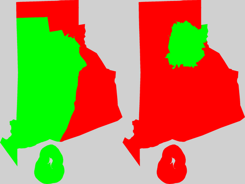 | Current: 20.145094022
My Way: 19.100405 |
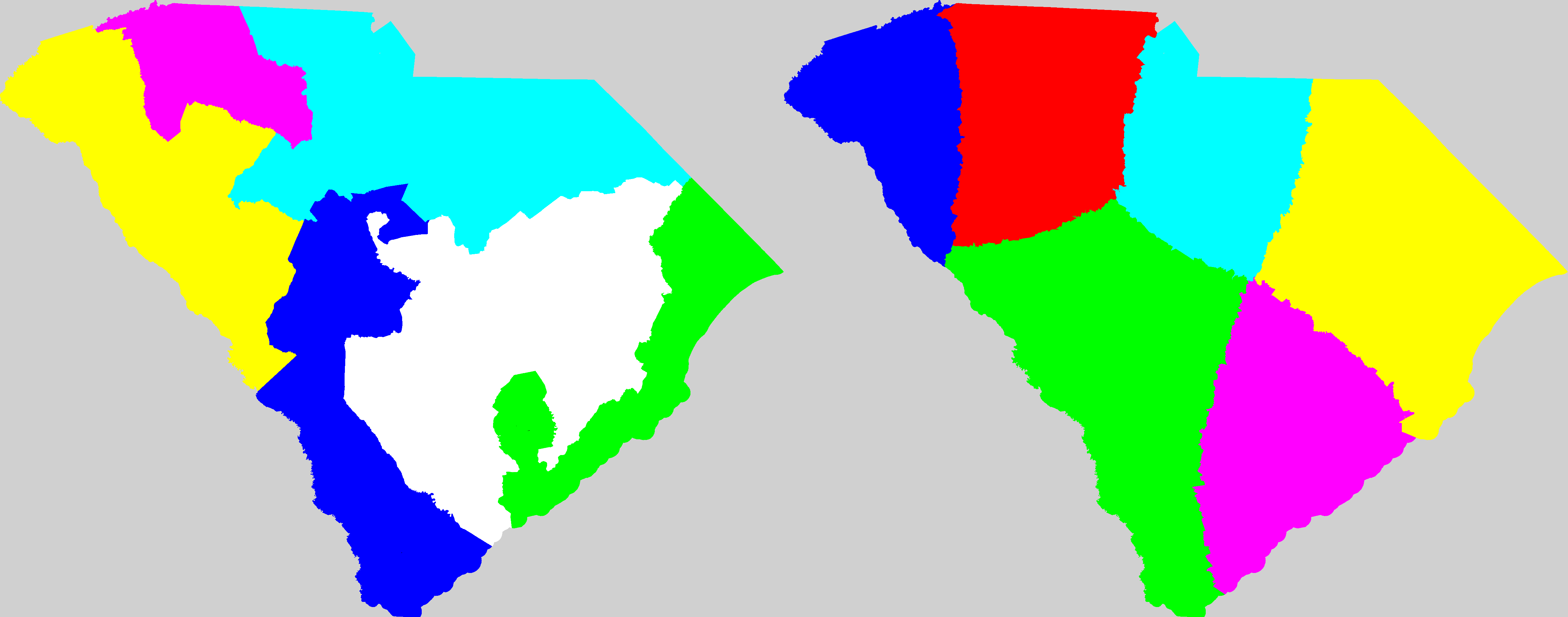
| SC |  | Current: 68.600375864
My Way: 51.042877 |
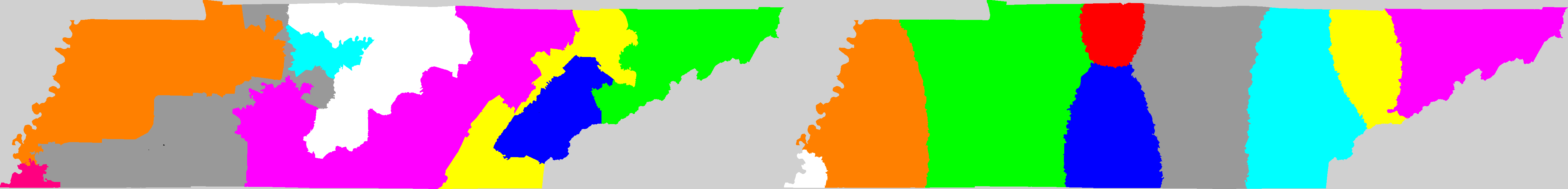
| TN |  | Current: 67.594785417
My Way: 48.826422 |
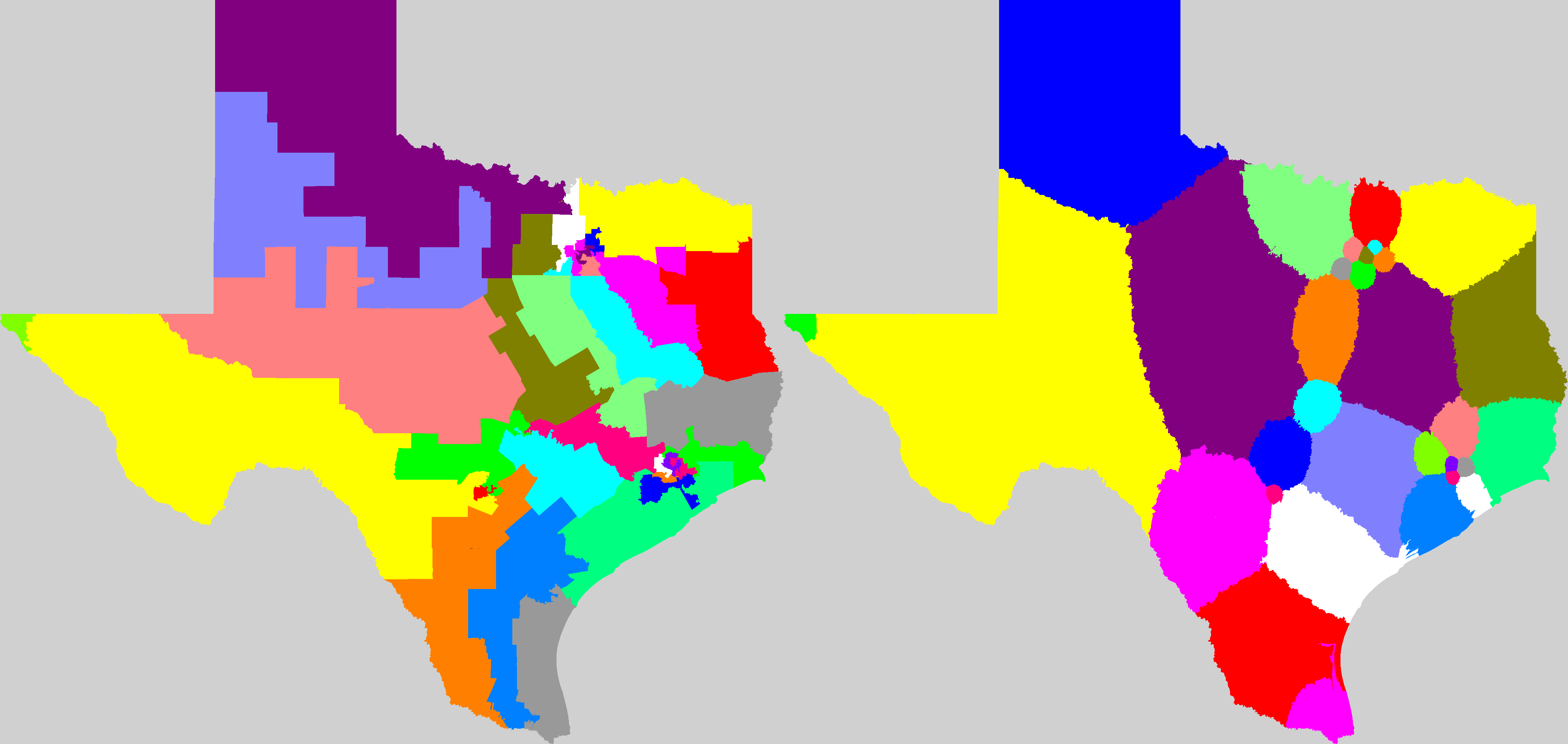
| TX |  | Current: 71.062717774
My Way: 51.928100 |
| UT |  | Current: 169.0268936
My Way: 102.128899 |
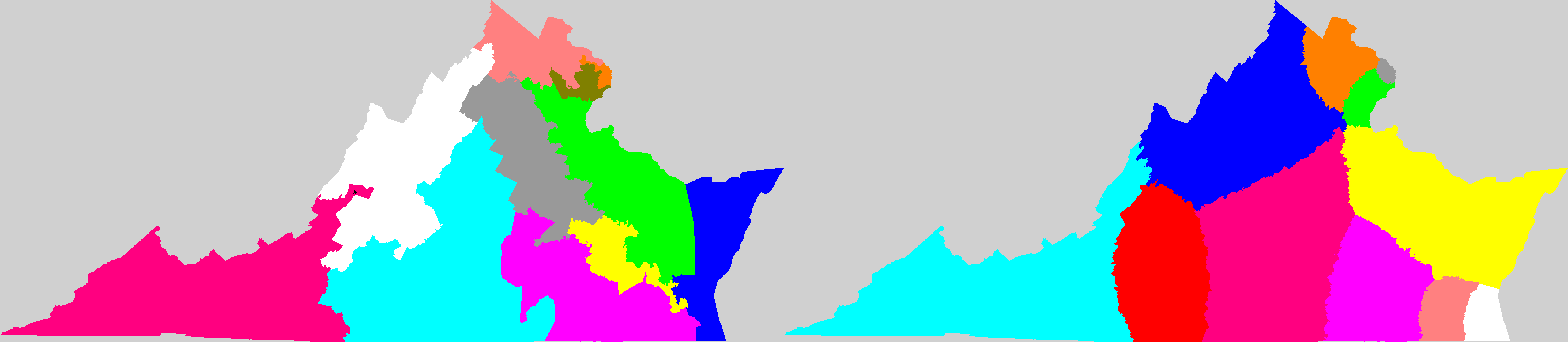
| VA |  | Current: 62.77242085
My Way: 45.497576 |
| WA | 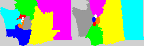 | Current: 64.881506257
My Way: 56.619464 |
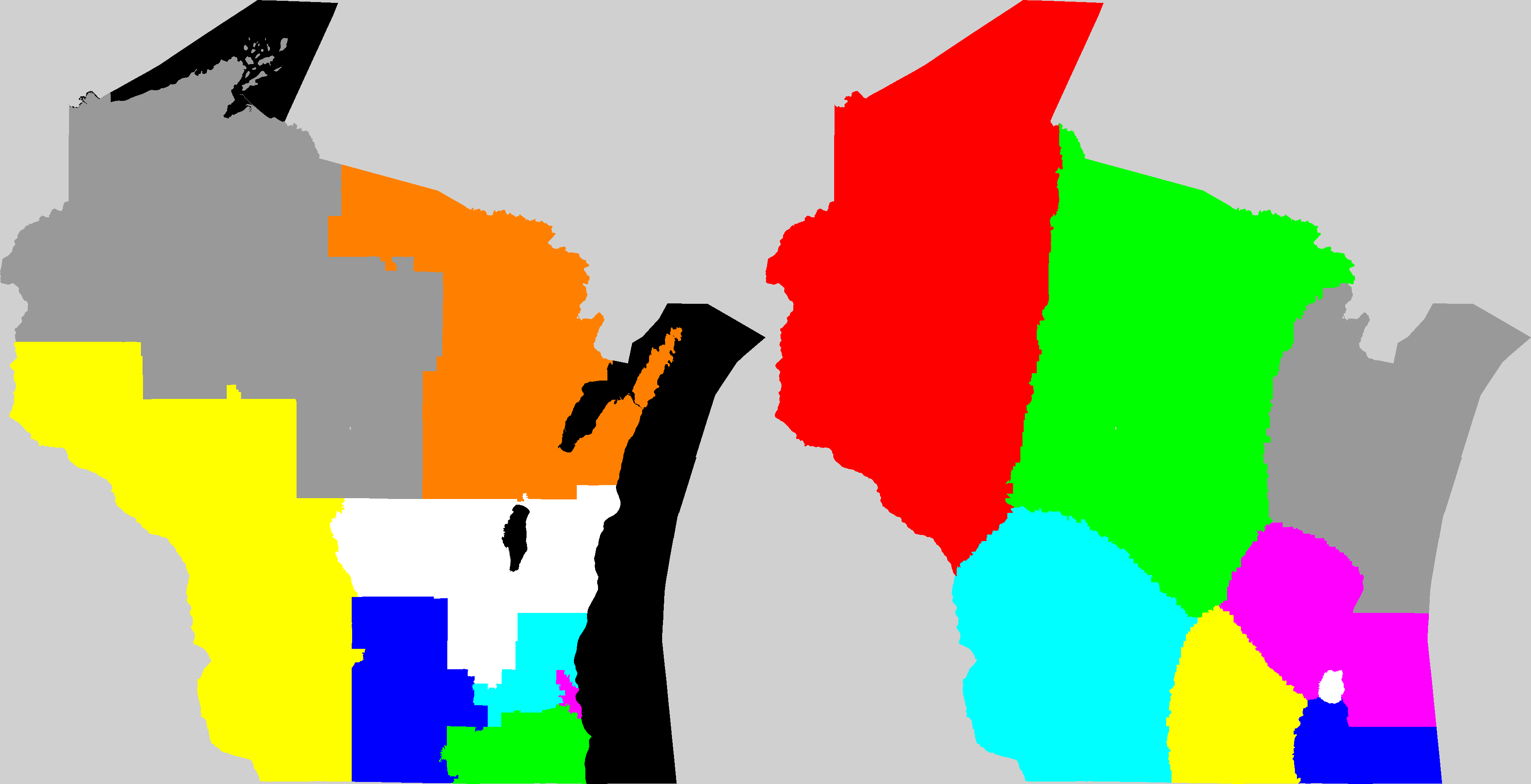
| WI | 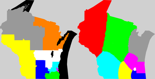 | Current: 64.545111191
My Way: 55.804623 |
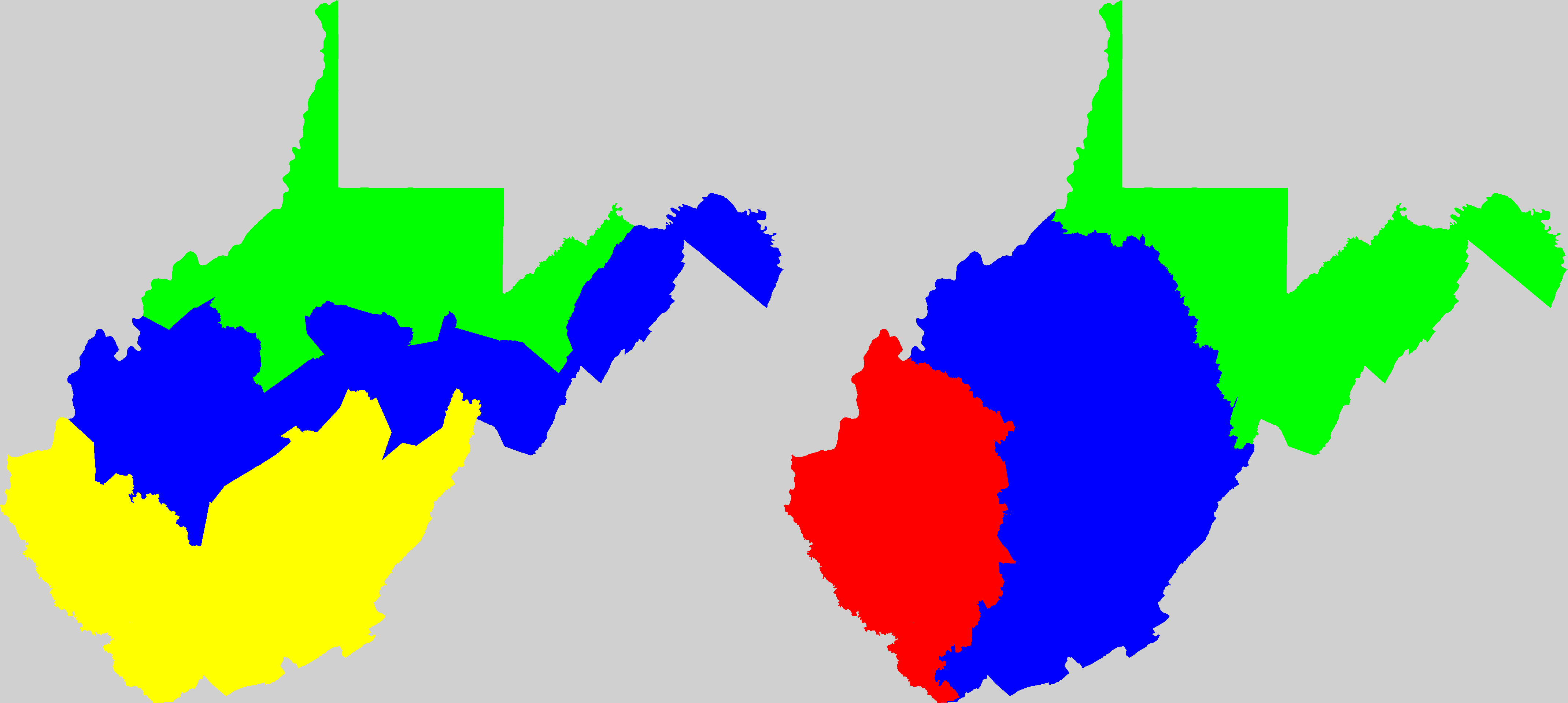
| WV |  | Current: 108.84436664
My Way: 86.032186 |
| States shown with current congressional district map and a possible solution I generated. (click for larger view) | "Km/p" is the average distance per person in kilometers to the center of their district.
"spread" is the difference in population between the least populous district and the most populace district.
"std" is the standard deviation of the populations of the districts. |
43 states. AK, DE, MT, ND, SD, VT, WY have only 1 district.
"Km/p" is the average distance per person in kilometers to the center of their district.
"spread" is the difference in population between the least populous district and the most populace district.
"std" is the standard deviation of the populations of the districts.
It's not quite perfect yet.
In those runs there's a range of 200-1000 people between the smallest and the most populous districts (0.03-0.15% out of about 650,000).
I think that should be close enough, there's probably at least that much error in the census data, but the courts might disagree.
For all their nasty gerrymandering, the current maps do manage to keep the districts to within a 1-15 person difference according to the official census tally for those regions.